The Knitting Nurse

Rambles and Travels


Leave a comment

East Side of the Sierras – Part 3 of 3 – Into the Great Park I Went

Here are the final pics from the big trip over the Sierras I posted here and here.

While the weekend tourists swamped Tuolomne Meadows I was poking around ghost towns and out in the open hills of the valley soaking in hot springs and admiring the views.

Watching dust devils in amazement:

I checked out Obsidian Dome just outside of Mammoth.  Remnants of a volcanic eruption 500-600 years ago, the slow-moving flow left a pile of glassy obsidian a mile long and 300 feet tall.  Fascinating.

The Paiute Native Americans used the rock for tools.

Once the weekend passed I headed into Tuolomne Meadows, the higher-altitude portion of Yosemite National Park.  It was so crowded in that park over the weekend it grossed me out and I left for quieter places.

Tuolomne is really spectacular with granite domes and formations as far as the eye can see.  The weather was perfectly cool.  I found some nice high spots to take it all in.

Note the glacial erratic boulders sitting on top of this dome:


These are the views I love. Wide open:


A particularly lovely hike along the Tuolomne River brought me to a broad meadow where I enjoyed a picnic and worked on a little knitting project in peace and quiet.


The river narrows in spots, the flow quickens and you can see it’s carved out a path through the granite.  Saw many perfect swimming holes but having no suit with and crowds present did not mix.


I was fortunate to have my first Yosemite rock climbing experience. That granite is superb!

I was sad to leave this area.  Sure have a hankering for more. Tulomne will close soon since the road’s at such high elevation.  But there’s Yosemite Valley to visit.  The crowds should disperse soon.  Hmmm…


1 Comment

East Side of the Sierras Part 2 of ? – Masonic, CA, More Relics of the Gold Rush

A docent at Bodie recommended a side trip to the ruins of former mining town MASONIC.  It was a great side-trip.

One leaves Bodie (below) and heads out a dirt road for 16+ miles.  At first I thought is was 2WD but in time it proved 4WD.  Rain would make it miserable.

BODIE POST Link

It was a gorgeous day.  Though only in the 70’s, at 8,000′ the sun was strong.  More like the high desert climate I’m used to I was in paradise.   Though I love my perch by the ocean, I really miss dry heat, having a little less air over my head and sweeping vistas of both nothing-ness and topographical relief.

That drive, though short in miles, took some time.  I poked along, at times needing 4WD.  There were plenty of “rest stops” to just sit, snack, and take it all in.

Less than 2 miles from the NV border and less than, oh, 15 miles from the feet of the Sierras the views didn’t stop:

Some background on MASONIC:

A 16-year-old young man from nearby Bodie found gold in the Masonic gulch in 1900. He named his claim Jump Up Joe Mine.  Small claims followed.

1907 brought the Pittsburg-Libery 10 stamp mill. This grew into a mining district some 6×12 miles in area with >40 claims.  Pittsburg grew to include a mill and a cyanide plant with a cable-bucket tram system enabling them to process their  own ore, eliminating the costly shipment of it to outside mills.  It was considered one of the best producing mines on the CA/NV border at that time.

MASONIC boomed, like most of these mining towns.  Unlike most, though, it was considered a ‘clean’ town with no (unbelievably) churches and (more unbelievably) no brothels.  At most, 1,000 resided there with the population plummeting to 12 registered voters in 1924.

Some remains:

A lone inhabitant:

Leaving the mine, on top of New York Hill (don’t you just wonder who and why named it that?) Dark rain clouds moved in along with gusts of wind and I was the tallest thing around.  I didn’t dawdle as I wished to.  The view was spectacular. I wonder if they appreciated it?  Masonic sits in the gulch below the trees in the bottom of the photo.

A few roads leading to unknown places caught my eye.

Pointed west down hill where the road terminates at Bridgeport.  Found more.

The CHEMUNG MINE is 3 miles west of Masonic.  Rapidly decaying, it functioned from 1909-38 with a brief occupancy (by what sounds like an eccentric and unhealthy but friendly old man) in the 50’s.

I was wary to enter. Being solo, I don’t enter structures.  Though judging from the online postings many have stepped into this rickety skeleton. It’s reputed as haunted.  The story is, a nasty owner was thrown into a mine shaft.

I’d like to share a fascinating book I picked up in Bodie.  The Mining Camp Speaks, by Beth and Bill Sagstetter.  From Denver, this couple’s compiled the ultimate reference book to understand the flotsam and jetsam of mine ruins.  Everything you ever wanted to know about machinery, types of structures, down to items in trash piles are spelled out here.  Nibbling at the book since the trip, I’m learning bunches.

It will come with on my next foray.  Perhaps I’ll better be able to ID a rusted generator, an assayer’s crucible, or gain a clue of the date of the  camp from the type of can I spot.

Beth and Bill Sagstetter, The Mining Camp Speaks

They’ve also written a similar book about Cliff Dwellings and have many published papers and research out there.  I hope to catch a talk by them when back in  CO.

Until then, dreaming of the next  out…


1 Comment

East Side of the Sierras Part One of ? – This is Bodie, CA

A couple months ago (I’m really late posting this trip) I spent 6 days on the east side of the Sierras.  I love it out there.

Death Valley in all its stark splendor shares the same stretch of road as saphire-blue lakes tucked below mountains topping out at 14,000+ feet.  Stands of gnarly, ancient pine perch above dusty hills peppered with volcanic rock.  Secret and not-so-secret hot springs  beckon.  Small towns that thrive on catering to the people who recreate host family run cafes, hotels, coffee-shops.  The entrance to the east end of Tuolumne/Yosemite also beckons.

Would be an isolated place to live. Work would be scarce. But I guess that’s what’s kept is as beautiful and quiet as it is.

+++++++++++++++++++++++++++++++++++++++++++++++

Bodie is a ghost-mining town. Located about 75 miles southeast of Lake Tahoe it’s tucked into the Bodie hills at 8300 some feet with views looking into both Nevada and the Sierra Mountains.   On my radar for years, each time passing the road’s been closed to snow.  This time all systems go.

Bodie’s in an ARRESTED STATE OF DECAY. This means people left.  Belongings and artifacts stayed behind.  Suffering much vandalism the area was made a park in 1962.  Full-time staff live there using snowmobiles in the winter to procure necessities.  The park was threatened to be closed in 2009 but made it through the budget scare.  CA’s parks are threatened. Hope  it continues to stay open.

A superb resource for more photos, stories and info on the mining process can be found HERE.  It’s well worth the click.

The largest mill is silver on the left. Tailings piles sit behind.  There were numerous mines, at one time only 2 of some 30 were profitable.  This is what led to the  collapse of the town. The 1940 War Production Board order forced the closure.

170 buildings remain of the 2,000 that once stood.  Fires, vandalism and time took their toll.

The brick bldg is the Dechambeau Hotel with the I.O.O.F bldg (stands for International Order Of Odd Fellows, a Union I believe) leaning into it.

Check out Cecile Vargo’s blog. She shares a wealth of Bodie history.

Used as a Park Ranger residence this is the J.S. Caine home. He owned most of the town.  It’s gotta be creepy living up there mid-winter with just a few around.

Inside the museum.  Now that’s a hearse with a view!  Modeled after the Abraham Lincoln hearse, there’s a coffin in it. Did they temper glass back then? According to one of the park aides, people dressed well treating parties and social events as grand affairs involving formal dress.

Inside the Boone store.

Looks like they practiced safe sex.  There was a sizable Red Light District and some 65 saloons.

Took the tour of the Standard Stamp Mill. Best 45 minutes there.  I believe our Park Aide’s name was John.  He lives up there.  He eats, sleeps and breathes the history of this town.  In his own gruff way he took us through the mine explaining the stamp process of crushing the ore, the chemicals used for extracting the minerals and much more.  So much, my head overflowed with it all.  I’d love to go back for a second round.

After using mules to transport ore from the hills in the background to the mill they devised a tram-like system.  It’s baffling what it took to get that gold out.

Stamps. Each weighing a ton, they moved rhythmically up and down, crushing the ore, which flowed over mercury coated plates releasing gold.  “Mad as a hatter?”  You bet. Many died from the poisonous mercury though there were no mercury-related deaths listed in official records, only “pneumonia” deaths which they contracted but from the weakened immune system mercury causes.

The noise inside that mill must’ve been deafening. Bees’ wax was used in their ears but still…


Yikes!  No OSHA back then.

Electricity came in eventually, allowing a generator to power the mill. No more coal. It was expensive. Needless to say, the wiring wasn’t up to code.

This place fascinated me and I can only hope I’ll have another trip out there before snow flies.  A “behind-the-scenes” tour’s offered of the closed area behind the Standard Mill.  Must take it.  I know the US’s archeological artifacts are a pittance to other countries.  But…it’s reassuring to see places such as Bodie preserved, studied and loved by many.


Leave a comment

Made it Back…

…from Tuolomne Meadows and the Bridgeport to Mammoth corridor with a head that’s a little clearer, a truck much dirtier, a hat and cowl nearly knitted and a bajillion photos to peruse and narrow down to share.

Walking out the door for work in 10 minutes.  Dreading being up all night.  The first night back is a killer.   If it becomes unbearable, as seems to be the role of the “float-pool-travel” RN, I can retreat to here in my mind:

And it will all be ok.


2 Comments

The LOOONG Road Home – CA to CO – Icy Wind and a Peek Into NV – Part One of ?

Feels like weeks since I’ve posted.   It’s only been a week but lots has happened since.  Big stuff.  Settled into the new temp job in Denver.   Every day’s been nutso-busy.  (What else is new in nursing?)    Yet I’m digging the folks I work with and the commute’s not as bad as I thought it would be.  Each trip in I thank my lucky stars it’s 0620 and not 0800.  Then, I may become a road rage statistic or forever locked up in slow-mo traffic.

Seeing friends, a welcomed gift.

Just started looking at pics from the HUGE trip from CA back to CO.  I chose the long way as there were places to see along the way no where near the expedient way back.  The quick way is usually NOT the interesting way to go.

Packed up all my meager goods, including Annabelle in the cat-cage. Wonder how she tolerates the road trips she’s been a part of this last year?  She did well, I must say.  Though I won’t subject her to another long one as such.

Desperately wanted to see Death Valley, Zion and No. AZ.  I went this way:

Of note, there were many back, little roads taken that do not register on this map.  Actual mileage was just shy of 1800 total to Denver.  Yep…a lot.  So worth it.

Made it past Tahoe, veered into  NV and hugged the border for awhile seeing some pretty mtns. Did you know NV has beautiful ranges?  All the mtn passes that would have negated the trip into NV, leading me straight south instead,  were closed.)

The Sierras lure me in. A trip in during the summer now sits high on my list so I can really get into them.

Near Little Antelope Valley? I really should note locations.  This 3 week delay in recall has details a little fuzzy.

IMG_5626 by you.

I was hoping to camp near Mono Lake, a sight I’ve blogged about previously here:

https://hfrank007.wordpress.com/2008/11/25/california-dreamin-part-3-of-trees-older-n-dirt-a-lake-saltier-than-the-sea-yosemite-where-are-you/

Also craved a trip to Bodie, a ghost town, just northeast of Mono Lake but at 8,000+ feet up, the road in is closed off.

Temp gauge in the truck read 30 degrees.  Got out for a leg stretcher and the wind nearly carried me off over the lake.  My cheeks numbed instantly from the windchill.  Plan B: Continued on, eventually stopping in Bishop where I stayed in a cheap, not very clean hotel complete with a TV remote the cigarette-stench-doused clerk gave me and an old-school gas wall heater that made me a little nervous to turn on.  But hey, it was out of the wind!

Woke the next AM with Death Valley the goal for the day.  Stomped around the Alabama Hills at the base of Mt. Whitney en route.  This scenic spot’s been the locale for many old western movies.

See a virtual panorama here: http://virtualguidebooks.com/SouthCalif/EastOfTheSierra/AlabamaHills/AUGAlabamaHillsL.html

It’s MUCH more descriptive than any snapshot I took.

Mt Whitney:

IMG_5651 by you.

Watched the temp gauge rise as I made my way to Death Valley.   I knew it would be warm in the day and chilly at night.  It was. But more on that later.  It’s late. Work starts early tommorow.   I’ll start the Death Valley pics on the next post.

A teaser:

Joshua Tree.  Lower Centennial Flat, Death Valley

IMG_5674 by you.


1 Comment

Where is Heather Now?

People are wondering, calling me, asking “Where are you, now?”  I left ABQ, emotions mixed, time for a new assignment.  I really miss the desert.  I miss my friends.

Spent a generous week in Golden visiting friends, which I miss dearly.  Sounds cheesy, but, if there’s one thing I’ve learned while doing this travel RN stuff is friends and family are what you call home, not the drafty, overpriced duplex apartment you rented or, in my case now, the cheesy, drafty, overpriced “efficiency” hotel room I now rent.

I’ll send out an email with my new address. Phone number stays the same.

Stockton, CA is VERY different from what I’m used to.  I have been here one week and have not found any bike paths, scant bike lanes on the streets (the ones that do exist are on very major thoroughfares that I wouldn’t dare pedal on).  I’ve found no Community Rec centers, the YMCA offers only childcare, no fitness.   Today I’ll have to succomb to the 24 hr fitness giant.  Blah…the guy at a bike shop laughed and said “Where are you from?” when I asked about road-bike friendly roads near by.  He did give me info on a local biking group, though.  Bingo!  I hope they can help.  I may have to drive a bit to find safe biking territory.

There are more for sale signs on homes than I’ve ever seen. This was the #1 foreclosure city in the US, from what I’ve heard.   I’ve seen some huge homeless shopping carts parked and rolling down the streets.  It feels a little desperate here.  The downtown is scary.

It has not been sunny, yet, not one day.   Foggy and cold.

All this aside, I am no longer living out of my truck.  Annabelle has a bed to sleep on.  I have a comfortable room that provides me with a roof over my head, a tiny kitchen, a bed larger than I’ve ever had, (Annabelle still manages to park herself at my head in the AM despite the vast stretch of mattress available) a TV (with basic cable, which could be a bad thing. Though, no HGTV, History channel or Discovery channel which are the only things worth watching, I think. Ironic, eh? )  A sitting room, eating room, and office all rolled up into one neat room!  I am happy.  Safe and happy.   Pics to follow.  It really is funny, I think.

I’ve been gifted a new friend, Yvette, whom I met the first day here in a coffee shop.   She’s destined to be a “lifer” friend.  I’m looking forward to spending some time hanging out with her (after her finals are over).  She’s headed for nursing school!

Tommorow I start work.

This last weekend I celebrated the last of my time off with a quick trip to Yosemite. Just 2 hrs away (the “quick” way) I took the not so quick way.  Drove down the 99 to Modesto where I wound through some very sad looking places, broke down houses along a RR track that punched along from east to west.

IMG_4830 by you.

IMG_4831 by you.

Entered a valley of many nut trees. Their leaves brilliant yellow, what few were left. Sorry for not having a pic.  Passed the oddest, tiniest little cemetary just outside of La Grange.  Was a dirt patch with a pretty view.  Headstones were really old, those with discernable dates.  Most were toppled over.

IMG_4841 by you.

IMG_4842 by you.

Got into the foothills, which are really pretty.  Hills rolled.

IMG_4844 by you.h Revisited the little  town of MARIPOSA and stopped for gas and firewood.  I’d stayed there one night on my October trip to CA.

I could live in that town.  It’s cute, the people were all friendly.  Reminded me of Golden on a much smaller level.  At the grocery store, an employee in an electric wheelchair was cruising through the lot pulling a cart behind the chair.  Solicited many laughs, mine included.  Made it into the south entrance of Yosemite in time to find camping just as dark settled in.

Brrrr….it was cold.  Not as cold as the first night of camping  I had in UT last week, but close. Thermometer in the truck read 29 in the AM but the humidity was least 75%, probably higher.  Stayed warm, though. Couldn’t keep my fire going that night, though.  I failed at it, really.  I’m blaming it on not having any dry kindling.   Crawled into the sleeping bag at, oh, 6:30 PM and read for three hours.  Felt great!

Woke, made coffee, went to the Mariposa Sequoia grove.  Road closed in winter so I thought I should get up into it.  Wow!

Just goes to show humans can’t always be the largest things on the planet.  Those trees make me feel small.  I thought this GINORMOUS truck, dwarfed, was humorous.  ; )

IMG_4856 by you.

This tree fell, thousands of years ago.  It stretched on over the grove floor.  Aparently, sequoia roots are very shallow, only 6 feet or so underground but spread out. This makes them succeptable to damage from people walking over them.  Like I was…

IMG_4867 by you.  The sheer size. Looking up and seeing them sway.  I heard some critter making a banging ruckus up high in one.  A woodpecker, perhaps?

IMG_4859 by you.

Fire is key for their propegation.  This was a burned out grove.  Kinda reminded me of a book I read, The Road by Cormac McCarthy.  REally fabulous but not easy on teh psyche. Approach with caution if you choose to read it. If you like it, you will not put it down, at all, really.

IMG_4860 by you.

And this:

IMG_4863 by you.

Made it up Glacier Point Road as well. No snow to close it, yet.    Came around a bend and then WHAMMO!  A continuous expanse of rocks. Half-Dome in the foreground.  Waterfalls, peaks, more Sierra peaks in the background.  On and on.  I was drooling.  Glad to have had the opportunity to see the view.

IMG_4880 by you.

See the three waterfalls in the middle?  The closest is Vernal Fall with Nevada Fall behind it and,I believe, Illilouette Falls high above. Not positive.  All are part of the Merced river. The noise!  The roar of the water falling, heard by me from so far away, was mind-boggling.  Libery Cap is the half-dome shaped chunck of rock to out left of Nevada Fall.  Half Dome is not in this pic.

It’s HERE!  It’s stunning. It makes me want to stand next to it and kiss and hug the rock.  Someday, I will return to climb it. Someday…

IMG_4881 by you.  Half Dome-Tenaya Canyon to it’s left.   This does no justice to it’s scale.

Curious about Badger Pass ski area.  Had to sneak past the closed sign and check it out. Looks like I won’t return with a sled?  Looks pretty tiny.  Reminds me of Trollhaugen in WI.  Wonder how much you don’t see from the base?  Packed the skiis.  Wil have to return.

IMG_4887 by you.

In fact, saw much evidence of many XC ski trails. I hope to return for some slow-shoeing and XC skiing this winter. Will be fun to be in the park with snow, nearly empty of others I imagine. Will have to pony up for a room though. I’m not hardy enough for winter camping these days.

Dallied in the Valley for a bit, saw the educational movie at the visitors center, ate, stood under El Capitan and gawked for a long time.  It’s huge.  Really huge.

Below:  Looking up the valley.  El Capitan is the big, beautiful wall in the front left.  Half-Dome peeks out in the back.  Bridalveil Falls is in the right front.

IMG_4890 by you.

That was it!  A quick trip in and out, was very glad to have the park mostly to myself. If you’ve been following this blog you may remember I was turned away from Yosemite in October by throngs of people and thick fog. Much better, this time!

Now, back “home.”  Blogging away, attempting to catch up.  Large to do list for today.


1 Comment

California Dreamin’ – Part 3 of ? – A Lake Saltier Than the Sea, Yosemite? Where are you?

So behind…so behind…

Bloging’s playin second fiddle to everyday life these days.  I can’t keep up!  Sunday or Monday I point west for California, all I need packed into the back of my trusty new truck.  Finally caved in and traded in the fuel sipping Ford Focus for something much more practical, a Tacoma.  She’ll be a traveling machine, capable of taking me over bumpy back road and act as a sort of turtle shell on my back, perfect for camping out of (or sleeping in). 

I start work in Stockton, CA 12/9. 

Until then, I’ve a few more days to spend in Golden, CO, cherishing the time spent with friends.  Here’s where home TRULY is.  Been knitting a lot, really, getting frantic re: Xmas gifts.  Every year I over plan and have not enough time to finish all.  You’d think I’d learn.

Below, another post from the CA trip, I figure I should get it all laid out before the CA pics start to fall behind the new CA pics! 

Drove along the Sierra’s with two stops in mind, The Bristlecone Pine forest and Mono Lake.  Yosemite would be the last stop of the day.  The pass in was closed, though, and I had to come to terms with a major rearrangment of plans. More on that. 

IMG_4079 by you.  Weather, up high, would hate to be back in those mtns. Still, so beautiful

  IMG_4081 by you.  Past more purdy hills around Mammoth.

Then, Mono Lake.

Located in Inyo Nat’l Forest, just past the Tioga Pass entrance to Yosemite, this anomaly snuggles up to 13,000 feet peaks.  An inland sea, Mono Lake is one of the oldest lakes in the US.  Having no outlet, it’s salinity is greater than the sea.  Those who brave the icy water are super-boyant.  I dipped in a hand. Brrrr!  Not brave enough to try.  No fish live in the water, however, brine shrimp and fly larvae provide a crucial and fragile link in the food chain for numerous birds and critters. 

TUfa (too-fah) are the tower like stacks you see in the pics. They are the remnants of fresh water springs that once bubbled up into the lake.  Calcuim carbonate form the deposits.

Volcanic formations surround three sides of the lake, the last eruption only 640 years ago. 

This is an area I can’t wait to return to.  There is no camping by the lake. It is quiet, except for the chitter chatter of thousands of birds.

The lake was once drastically drained by the folks managing LA’s water.  This was stopped, though the water is hundreds of feet lower than agreed to. 

I couldn’t help but notice how fragile it all seemed. 

IMG_4088 by you. Tufa and the skyline to the north.

  IMG_4093 by you.  Mandated lake level.  So far away.

IMG_4098 by you.  Looking West  IMG_4101 by you. Moi, comoplete with camping bed head.

IMG_4102 by you.

IMG_4109 by you. Buzzing critters aplenty.


IMG_4111 by you.  Looking West.

IMG_4125 by you.  Sat and worked on Rachel’s B-day gift for a bit. 

YOSEMITE, Here I came!  Wait…where is it?

Next, to Yosemite.  I got lucky and the pass in opened.  If not, I would’ve needed drive north to nearly Tahoe and detour around, a LONG detour.  word spread in the visitors center Tioga Pass opened.  Yippee!

IMG_4131 by you.  Yellow leaves near the entrance.

A glimpse into the park while I could still see where I was.

IMG_4136 by you. 

That didn’t last long.  The fog socked in.  I was enveloped in fog for al least 75% of the park.  Nada, nothing, slow driving through a white blanket.  Was I disapointed?  Yep.  Rock outcroppings teased me with a glimpse of ankle.  I’ve wanted to climb here for years and years and years…


IMG_4150 by you.

IMG_4138 by you.

Peek a boo!

Made it into the main valley, a glimpse of El Capitan.  Was raining and cold. Looked into camping and there were only a handful of canvas tent sites at$90/night.  I was so annoyed, so disgruntled, I poked around and left.  Yosemite, I will be back, next time likely with snow on the ground and skis or snowshoes on my feet.  Tourists warm at home.  Can’t wait…

IMG_4148 by you.  El Capitan

So onward I went, to the little twon of Mariposa, cute, warm in a cheap hotes (much cheaper than a canvas tent.)  Out came the maps to plan the next day.  More on that later…


2 Comments

California Here I Come Post 2 of ?-Sombering visit to a Nat’l Park

Whew! Really falling behind on the CA trip pics.  Here’s more:

Ok…pointing up the Owens Valley towards Yosemite, drove past a sign for a Nat’l Park I did not sleuth out on my pre-trip reading.  One major bldg, which looked like a high school gymnasium from the past, stood solitare off the road. Huh?  It was a side-trip that changed my whole outlook on the day, one which I was not emotionally prepped for.

MANZANAR-A “war relocation” camp for Japanese Americans, was one of the 10 strewn through 7 US states during WWII.  It opened in 1942. It closed in 1945.  What an ugly strike through American history.  How foolish.  Without due process, 120,000 people of Japanese ancestry were rounded up, with only days to pack, to figure out what to do with their houses and businesses, their posessions.  Put yourself in ther shoes. What would you do?  What if your neighbors distrusted you?  Housed were boarded up, businesses abandoned.  All those years working hard to build a new life in the great America.  It’s staggering.  2/3 of those interned at Manzanar were AMERICAN CITIZENS by birth.

IMG_4025 by you.

Pulling into the parking lot I had a heck of a time figuring out what the park was until I found the sign explaining.   I also happened upon to men on bikes, I’ll call them D and G, who’d ridden from San Francisco.  Yep…that’s burly.  We chit-chatted, ate breakfast on the building’s steps (not quite open yet)  and proceeded in once open.  An amusing observation: Notice the two bikes and thier differences?  One rider was dressed in fancy, high-tech clothing with a newer bike with newer components. The other, older (but obciously much cared for.  His clothing consisted of woolen leggings and shorts, a wool sweater, old tennies glued together many times with the same elephant snot looking goo that held the hat brim to his old, foam helmet.  I loved it!  Enjoyed chatting about the area, got some San Francisco travel tips from two.

IMG_4026 by you.  Trusty steeds, compared.

IMG_4027   Close up, an effective helmet modification if I’ve ever seen one!

IMG_4028 by you.  Check out the beautiful, leather saddle!

I aspire to long bike tours as such. Someday.

Inside the interpretive center I watched an educational film (I love watching those) with loads of actual film footage from the operating camp.  It varied from publicity shots of shiny-faced teens going to their “dances” to dust storms and narratives from former employees.  (The nurse’s recount was particularily interesting as she had no running water in the hospital for some time.)

500 acres of housing was surrounded by barb wire fences and guard towers.  One man recounted, in the film, how he felt when he first realized the guns in the towers were pointed inwards, not outwards. They were told they were there to “protect” them.  The place was mostly self-sufficient with the prisoners (I will call them that because they were) raising critters, farming, gardening, runnign the mechanic shops and what little retail they were allowed.  More that 10,000 prisoners were crowded into 504 barracks organized into 36 blocks.  Privacy was non-existent, sheets making the walls between families.  This is a private culture.  How does a traditional, eldery Japanese lady bathe in a public bath house?  Must have been humiliating for some.

Imagine coming from temperate LA to a place where the winds howled, rain fell through the roofs, summer highs reached 110 and winter was bone chilling cold with snow?  People described waking covered in an inch of dust.

IMG_4031 by you.  
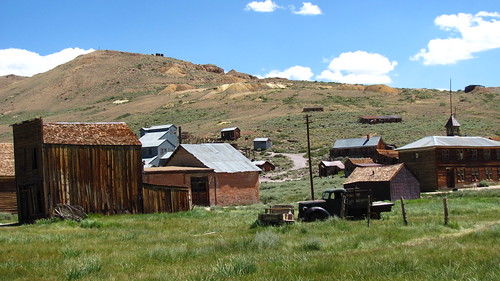
One of two barracks still standing.  Now, the landscape is scattered with foundations, bits of pipe, concrete, not much left.  Eery…really…made me feel almost an intruder.  To return there, as a former prisoner, how strange it must be to see so little of what was an entier ‘town’ at one time.

IMG_4029 by you.  Signs are throughout the park, marking the locations of former buildings.

What moved me the most, I think, was the mention in the movie of hoe the prisoners gardened.  A traditional skill, many carved little gardens out of this arid patch of dirt.  Olf filr footage showed them working in them and strolling through what must have been little oasis.  One such garden was unearther next to the location of the former mess hall.

IMG_4036 by you.  See the pads/footings to the right?  While investigating here a nice park ranger informed me of a garden set back in the trees recently excavated.  Pictures below, it was large, had a  water feature, big stones, a memorial marker was placed.

IMG_4039 by you.

IMG_4043 by you.

Having a green thumb myself, I hope that the few gardens strewn throughout the camp were a source of peace, distraction and hope for the prisoners.

A memorial is at the far west end of the camp.  There lies a cemetary, human and pet.  Caught in the brush around I noticed little paper shapes. “Strange,” I though.  Looking closer, there were hundreds of origami creations left on the graves, in the bushes, tied to the fence that surrounds the memorial.  Small but beautiful bits of color against the drab browns and greens of the arid land.

Symbolic, I think.

Never been to a National Park like this.  Glad for the education it provided me on a tragedy I’ve always known about but have never seen the history up close.

Next post:   Mono Lake:   Here’s a sneek Peek:

IMG_4088 by you.

A lake saltier than the sea.


1 Comment

California Dreamin’-Part 1-First Class Luxury, Stepping into the sauna, Next stop a world away.

Oohhh…I am so behind.  Seems I’m doggie paddling to keep up lately.  Lots on the plate.  This weekend I’m enjoying a retreat to CO. No work, only play.  Time to catch up on the old blog.  Below starts the first of the 

BIG TRIP TO CALIFORNIA 

posts.  (I just figured out how to do colored text. Bear with me.  I may be like a first grader who discovers the comma and uses it everywhere.)

I’m one fortunate woman.  Working as a travel nurse allows me to, well, travel!  Not being tied to a facility’s regular staffing means I can write periods of time off into my contract.  Working three 12’s a week, when cleverly planned allows 9 days off.  As a contract worker I don’t have the benefit of paid time off.  It’s worth it.  I’m not constrained by the piddly 10-12 days off a year most Americans accept as customary and usual.  I’d smother.

Originally, I had 23 days mapped out, in early Aug., for a massive trip from ABQ to Oregon and back.  Pesky knee fell apart, had to use that time for surgery and recovery.  See blogs in the August 11th time-frame for more on that.  A new contract starting in Oct. allowed a one week time off request. Granted.  Wah hoo!

Knowing I wouldn’t be as mobile as usual, I knew this trip would be heavily sight-seeing oriented.   Often, though, I felt pangs of longing when looking off into the hills next to the Ocean or into the Sierra mountains.  Wanted to retreat.  Got out of the typical travel pattern and had more time around people, choosing to stay at hostels most of the time.

Here’s a funny story. I FLEW FIRST CLASS!  Yep, for the first time ever.  I had a United coupon for a free upgrade that expired that week.  “Will the seat be squishy and wide?” I wondered.  “Will there be a blanket?”  At 0830 it was too early for a cocktail.  ; )  Was a little 40 seaterplane.  First class equalled being the only one in my row, no one in front of me,  with full stretch out leg room.  Got a glass of OJ right away.  That was it!  Too bad I wasn’t on a 1,000 mile flight. Still, what a way to start a journey!

Dropped through the layer of smog into LAX.  Been there once.  Saw enough to know it is a big, big place that moves too quickly for me.    Grabbed my bags and stepped outside.  Whammo!  The humidity!  I could feel my hair turn to a brillo pad of frizz.  Picked up a rental car, a Toyota Corollo.  “Good gas mileage, I hope.”  Was spot on.  Must’ve had around 33 mpg.  Not as good as my trusty car.  Another bit of the story.

Having just 12 days to travel, I opted to fly rather than drive to CA. This meant I couldn’t pack the car with all my usual car camping/travel accouterments (folding chair, cooler, fleecy blanket my sis Karen made me for X-mas one year and goes everywhere, coffee making supplies, stove, the kitchen sink).  Instead, it all fit in a huge suitcase and one carry on. The big daddy weighed in at 44.2 pounds. Suh-wheat!  I knew that meant shipping home souvenirs, though, would have to avoid buying books, something I enjoy as mementos.

High-tailed it out of LA, early enough to miss traffic (the thought terrified me).  Drove though  sight, though.  Passed on Death Valley.  Didn’t want to rush through. That’s another trip yet to be told.  Made it to Lone Pine,  a tiny town at the foot of Mt. Whitney, a picturesque 14’er, and looking to have much granite on it.  I hear the climbing’s fantastic.  I drooled.  Was a long day of planes and automobiles.  (Sans Trains)  Get it?

Had planned to camp that night but the VP debate was scheduled and I couldn’t get it through radio so I ponied up for a room at a cute little hotel so I could watch it.  An old hotel, complete with rooms that share a bath at the end of the hall, I splurged on one w/a private bath.  Apparently, much Western flick filming’s been done there.  There were kitchy, signed pics of western actors and newspaper clippings all over the lobby. I loved it!

  (Photo from Wikipedia) Topographical detail of Owens Valley and surroundings.

OWENS VALLEY

This 75 mile long valley is hemmed in by the Sierra mtns on the west (at 14,000′ plus) and the Inyo and White mtns on the East.  This makes it one of the deepest valleys in the US.

Ever seen the movie Chinatown?  It’s good. I recommend it.  Owens Valley was the scene of the infamous CA water wars.  Once, the Owens River and Lake fed local farmers water for crops and orchards.  The LA Aqueduct, completed in 1913, drained the lake turning it into an alkali flat.  Greed and corruption flourished instead.  Nasty dust storms plagued the valley.   Neighbors were pitted against each other, politicians profited, violence resulted, local farmers sabotaged the aqueduct in 1924. LA continued to acquire water rights to the land where water flowed into the valley, over 300,000 acres, drying up the lake completely, supplying nearly 1/3 of LA’s water.  Ground water was pumped up to meet demands.  The landscape changed dramatically, rendering the valley useless.  A second aqueduct was completed in 1970.

Years of litigation followed.  LA Dept of Water missed several deadlines to rewater the lower Owens Valley, set forth after efforts by concerned parties, including the Sierra Club and Inyo County.  Now, in 2008, documentation I found says it’s been achieved.  Still, the long lasting effects are apparent.  Farming practices, fire suppression, climate change are causing woody shrubs to overwhelm the grassland that once flourished.  I wasn’t sure what to expect upon turning north up the valley.  It’s dramatic, dry, dusty and sparse.

  Sierras to the West.  Photo from Wikipedia.  Not as much snow on ’em when I was there, but starting to collect!

IMG_3998 by you.

Lots of volcanic remnants seen.  Black rocks against the stark, bleached dirt.  Dirt roads leading into the hills that beckon you to explore.

IMG_4001 by you.               IMG_4002 by you.

IMG_4005 by you.

IMG_4006 by you.


IMG_4019 by you.

Contrasting rock formations.  How much water and wind was needed to round

out those outcrops?

IMG_4017 by you.  Mt Whitney.  Ooohhh…

IMG_4022 by you.  Birds I’ve never seen before.

A good nights rest (though riled up some from the debate) prepared me for the next leg of the adventure, Bishop.

More installments to come!